BREAKING: task force recommendations shape newly released Rock Springs plan
August 22, 2024 – Today, the Bureau of Land Management released its proposed Rock Springs Resource Management Plan, outlining management direction for almost 3.6 million acres of public lands in southwest Wyoming. The proposed plan clearly reflects and incorporates feedback from tens of thousands of public comments and input from local stakeholders, including the task force Gov. Mark Gordon convened in late 2023.
The Wyoming Outdoor Council and Wyoming Wilderness Association both served on the governor’s task force alongside representatives with interests in oil and gas, grazing, energy production, motorized recreation, sportsmen groups, and trona industry. The task force also included elected officials from communities in Sweetwater County as well as the Speaker of the House and President of the Senate for the Wyoming Legislature. This group developed more than 100 consensus-based recommendations, supported by all stakeholders, to improve the plan and delivered these recommendations to the BLM during the agency’s public comment period.
The BLM took the task force’s consensus-based comments seriously. The proposed Rock Springs Resource Management Plan reflects task force recommendations including maintaining access for the local trona mining industry, retaining the OHV play area in parts of the Killpecker Sand Dunes, and protecting the unique natural and cultural values of Boar’s Tusk.
In response to the plan’s release, WOC and WWA issued the following statements:
“We’re pleased to see the BLM incorporated public feedback and input from Gov. Gordon’s task force into a plan that serves local communities, iconic landscapes, and wildlife,” said Alec Underwood, program director for the Wyoming Outdoor Council. “Among other important agreements, the task force reached consensus on the need to protect gold-standard habitat and other significant natural values in the Big Sandy Foothills and Northern Red Desert, such as Boar’s Tusk. It’s encouraging to see the BLM’s responsiveness, as well as the agency’s efforts to build on the task force’s strong foundation where agreement wasn’t reached, as they did for the Big Sandy Foothills. While the plan could be improved — protections for the iconic big game migration corridors in the region, for example, fall short of the mark — we appreciate that the agency worked diligently to ensure that updated management direction will conserve some of our country’s best remaining wildlife habitat, while also maintaining all of the unique recreational opportunities found within the field office.”
“It is a testament to the dedication of all who love and care for the lands within the Rock Springs Field Office that the proposed plan includes some robust, durable, and reasonable conservation measures for the Northern Red Desert and Big Sandy Foothills. We applaud the BLM for making the hard decisions necessary to ensure these wild and working landscapes continue to thrive for future generations to use and enjoy,” said Lauren Marsh, BLM program manager for Wyoming Wilderness Association. “We are, however, disappointed that some key provisions in the draft RMP were not carried forward in the proposed plan, namely recognizing Lands with Wilderness Characteristics (LWCs) and important protections for the hoodoo-studded wildlands surrounding Adobe Town. Nevertheless, we appreciate the willingness of the BLM to take to heart the concerns of local Wyoming residents as expressed through public comment and recommendations from Governor Gordon’s task force. What you see reflected in the plan for the northern portion of the Field Office — and taskforce recommendations — is how much Wyomingites value wildlife and the wildlands that support them, even under the demands of a largely extraction-based economy.”
The issuance of the Proposed Resource Management Plan and Final Environmental Impact Statement initiates a 30-day public protest period and 60-day governor’s consistency review. The agency will finalize the plan after resolving issues raised in these processes.
Staff Favorites: Celebrating Summer on Wyoming’s Public Lands
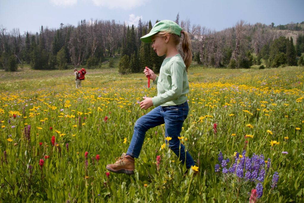
Summer is here — and if you’re like us, the shift in seasons means it’s time for blissful days on the water, solitude in the high country, hikes through wildflower-blanketed meadows, and otherwise enjoying all that Wyoming’s public lands have to offer this time of year.
Fortunately, with public lands encompassing over half of Wyoming, you don’t have to look far to find your new favorite summertime spot. From way-out-there wilderness to easily accessible trails, crags, and waterways, the possibilities are endless. We asked our staff to share some of their favorite summer destinations across the state, to inspire you to get out there and celebrate Wyoming’s legacy of protected wildlands. Whether your adventures take you to old favorites or new ones, to the public lands in your backyard or further afield, happy summertime exploring!
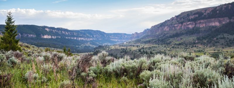
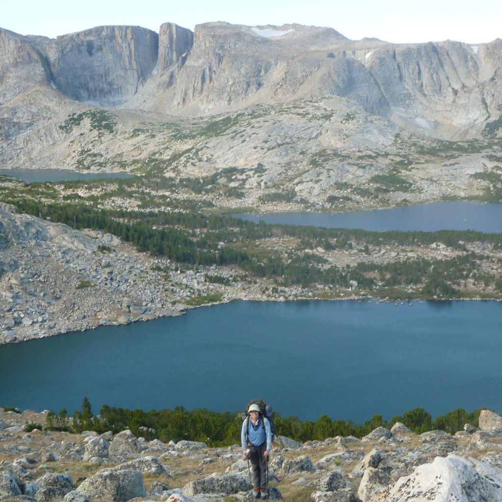
EXPLORING THE WIND RIVER RANGE
Era Aranow, government affairs manager
Rugged cirques, rolling meadows, and stunning alpine lakes: the Winds have it all. (Including notorious mosquitoes … If you plan an early-season trip, come prepared!) For Era, choosing a single “favorite” destination does a disservice to this vast and diverse range — it’s the exploration that’s meaningful.
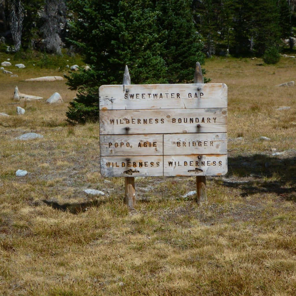
Fortunately, explorers have plenty of options to choose from. The range falls within two national forests (Bridger-Teton on the west side and Shoshone National Forest on the east) which encompass three wilderness areas. “It’s always a special feeling to pass that wooden sign and cross into the wilderness,” Era says.
In addition to the Bridger, Popo Agie, and Fitzpatrick Wildernesses, a part of the range’s eastern slope is protected by the Wind River Indian Reservation. In fact, the Eastern Shoshone and Northern Arapaho Tribes designated the Wind River Roadless Area to prohibit development on 188,000 acres of the Wind River Range in the late 1930s — nearly 30 years before the passage of the 1964 Wilderness Act.
Era in the Popo Agie WildernessSweetwater Gap, which separates the Popo Agie Wilderness from the Bridger Wildernss
Casting a line in the Wiggins Fork
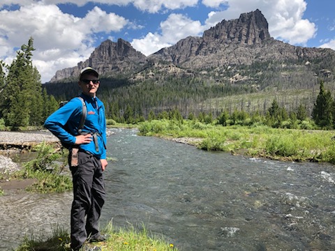
John Burrows, climate and energy policy director
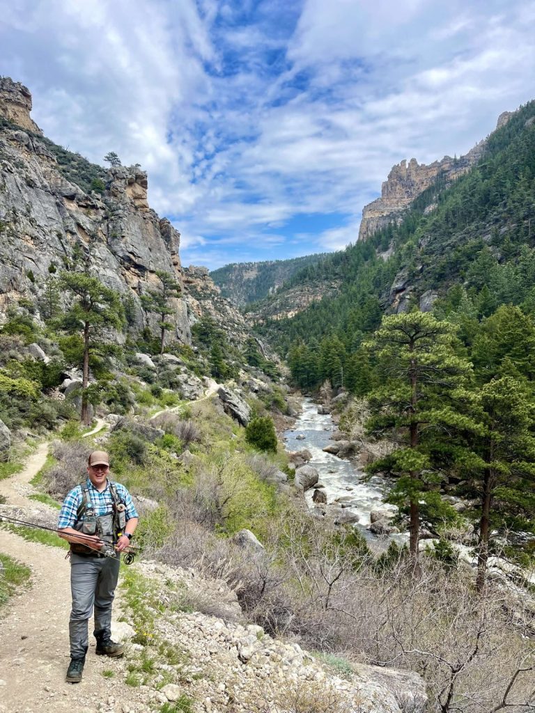
When the temperatures start to climb, it’s time to escape the lowlands and head to the mountains. “I’ll head up to Double Cabin Campground on the Wiggins Fork in Shoshone National Forest to cool off in the July heat,” John says. “It’s a great place to cast a line and a good starting point to explore the Absarokas.”
Just north of Dubois, this section of Shoshone National Forest holds plenty of opportunities, whether you’re looking to fish, boat, day hike, or backpack deep into the Washakie Wilderness.
Did you know? The Shoshone National Forest has roots as the oldest federally protected forest in the country. Its precursor was the nation’s first “forest reserve,” the 1.2 million-acre Yellowstone Park Timberland Reserve, which was designated in 1891 — part of a much-needed effort to prevent the destruction of the West’s remaining forests.
Wiggins Fork, Shoshone National Forest
Family adventures in Dubois Badlands WSA, Dunoir SMU, and the Snowy Range
Meghan Riley, wildlife program manager
For Meghan and her family, the central perk of living in Dubois is an abundance of options for adventures close to home. For late spring and early summer hikes and wildflowers, you can’t beat the Dubois Badlands WSA. Highlights, she says, include spotting mule deer and bighorn sheep and visiting cottonwood and juniper oases set against a backdrop of beautiful red cliffs. But what the heck is a WSA, anyway? “They’re areas that Congress decided might warrant wilderness protection, but they weren’t quite sure yet,” Meghan explains. “The idea is to gather more data and information before either designating it as wilderness, or releasing it.” Because WSA’s are managed as wilderness, they often have qualities similar to those of designated wilderness, such as non-motorized recreation and opportunities for solitude.
Dunoir SMUDubois Badlands WSA
For another backyard destination in mid or late summer, Meghan takes her kids hiking and backpacking in the Dunoir Special Management Unit of Shoshone National Forest. This 28,000-acre wildland northwest of Dubois features accessible front country terrain, but still has some wilderness qualities. “We can hike just three miles up the trail and find ourselves in the most beautiful wildflower-filled meadows,” Meghans says.
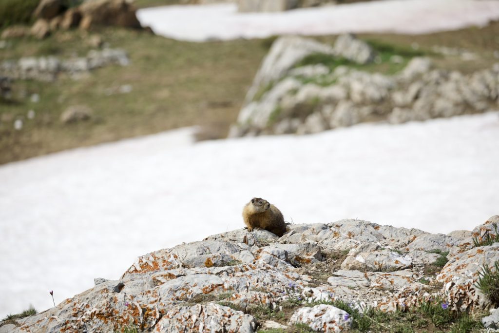
Finally, if she wants to travel further afield, the Snowy Range is a favorite spot. As a graduate student in Laramie, the Snowies, located in Medicine Bow National Forest, provided a welcome respite from the summer’s heat: “With its easy access and abundant wildflowers, it’s a beautiful place to replenish your spirit when everything dries out down low.”
A marmot in the Snowy Range, Medicine Bow National Forest
cool-water reprieves in Fremont Canyonand tongue river canyon
Carl Fisher, executive director
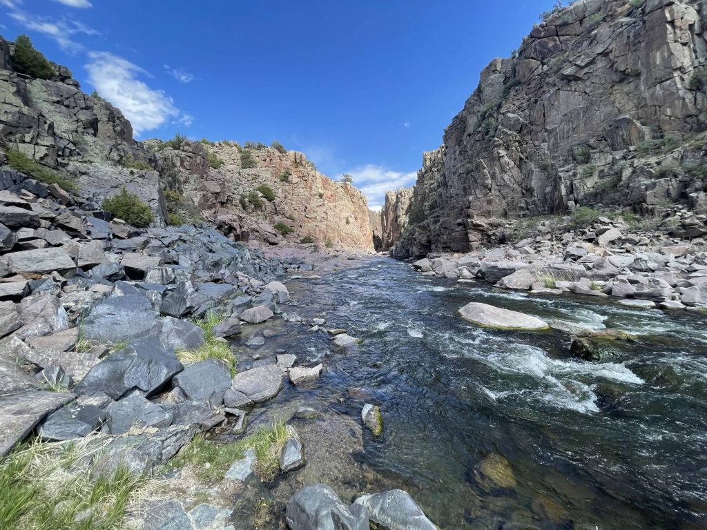
Carl’s first year on the job has seen him traveling to all corners of the state to meet with members and partners — and occasionally, he’s been able to sneak off with his fly rod to wet a line. The North Platte River’s Fremont Canyon, southwest of Casper, has been a frequent rest stop: With its spectacular granite walls, juniper-spotted hills, and, of course, clear, cold, trout-filled waters, the canyon offers excellent fishing with easy access.
Rather spend the day boating? The canyon is also popular with kayakers and canoers — and Alcova Reservoir is just downstream, too. Or, if you’re a rock climber, the canyon’s walls are dotted with hundreds of established climbing routes.
Another favorite of Carl’s is Tongue River Canyon in Bighorn National Forest, where the Tongue cascades through mountainous terrain dotted with pines and limestone spires. It’s a river he’s had the chance to fish with frequent travel partner Tyler Cessor, WOC’s development director — and the two are itching to get back!
Fremont CanyonTyler Cessor in Tongue River Canyon
Scaling Tensleep Canyon’s walls
Max Owens, communications manager
The pocketed limestone walls of Tensleep Canyon hold a special place in Max’s heart. And it’s not just because of the world-class rock climbing: “The expansive views of the plains at the foot of the Bighorns feel classically Wyoming,” he says. “And hiking down from the cliff through fields of lupine and balsamroot, and knowing that I get to do it all again tomorrow, always feels perfect.”
Bighorn National Forest is full of nearby hiking and backpacking options, too — including the spectacular trail to the summit of Cloud Peak, the highest point in the Bighorns. Did you know? This year marks the 40th anniversary of the passage of the Wyoming Wilderness Act, which designated the Cloud Peak Wilderness along with several other Wyoming wildernesses.
Tensleep Canyon, Bighorn National Forest
Where are you headed to enjoy Wyoming’s public lands this summer? What are some of your favorite Wyoming destinations and activities? Let us know in the comments!
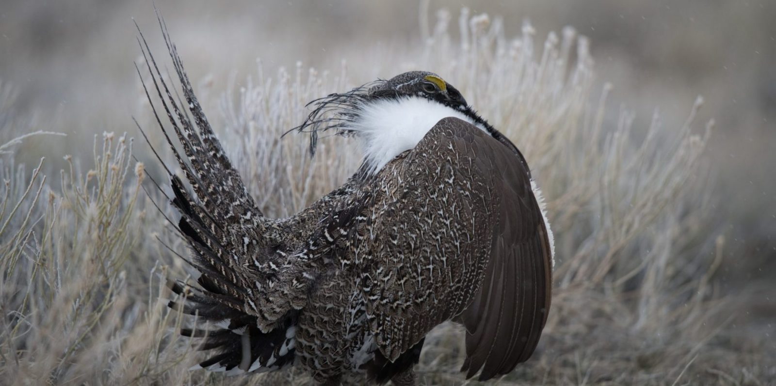
SOS: SAVE OUR SAGE-GROUSE AND THE PLACES THEY CALL HOME
Your voice makes a difference! Will you urge the Bureau of Land Management to take assertive action to save the Greater sage-grouse and Wyoming’s unmatched sagebrush habitat? Find suggested talking points to help you write your comment below.
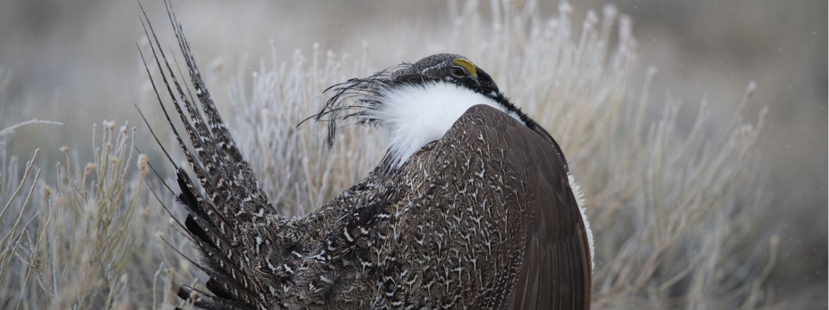
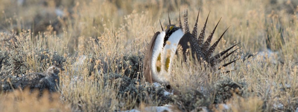
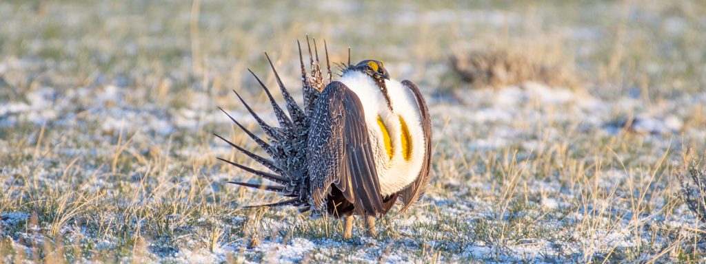
It’s no secret that the Greater sage-grouse, a symbol of the West’s sweeping sagebrush landscapes, is imperiled. Dire statistics on habitat loss and dwindling populations — echoed across studies and countless articles — paint a sobering picture for the beloved bird:
“Remaining sagebrush covers less than half its historic extent.”
“We are losing 1.3 million acres of sagebrush annually.”
“Sage-grouse populations have declined 80% since 1965.”
“Greater sage-grouse numbers have been cut almost in half over the past 20 years.”
From the heart of sagebrush country in Wyoming, where the ravages of invasive annual grasses and wildfire have yet to create the mass devastation they have in places like Nevada, it can be hard to comprehend how precarious the situation has become. But unfortunately, Wyoming is not immune to the threats eating away at sage-grouse populations and their habitats. Our state stewards the lion’s share of the world’s remaining sage-grouse and sagebrush — all the more reason to confront these threats head-on.
Of course, Western states have worked collaboratively for years to counteract threats and stave off an endangered species listing (read more here), but it’s clear more needs to be done to support sage-grouse. Fortunately, the Bureau of Land Management is now in the process of updating sage-grouse management plans across the whole of the bird’s range. What does this process mean for us? It means we have a chance to encourage strong action from the agency that manages more sage-grouse habitat than any other, including about 18 million acres right here in Wyoming.
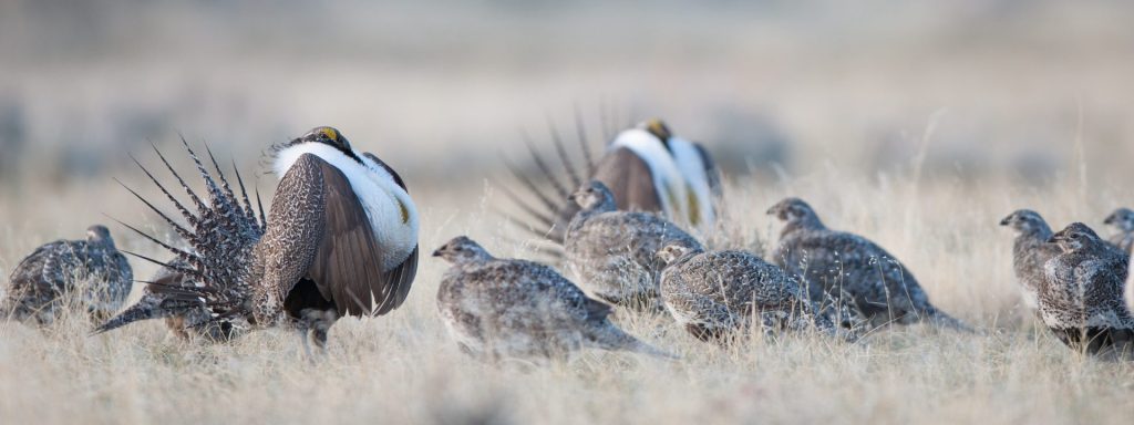
The sagebrush steppe is home to a rich tapestry of over 300 species. How the BLM manages sagebrush habitat has far-reaching implications for an entire ecosystem of plants and animals that need our help, including pronghorn, mule deer, pygmy rabbits, ferruginous hawks, sage thrashers, parasol buckwheat…. The list goes on! As go the sage-grouse, so go our Western rangelands and sagebrush dependent species — which is why it’s imperative the BLM take assertive action to protect sage-grouse and shore up the best remaining sagebrush habitat with this plan.
We can all play a role in guiding the agency to do just that. The BLM is accepting public comments through June 13, and your comments have the power to shape the final plan the BLM adopts.
In addition to sharing your personal connection to sage-grouse and the sagebrush ecosystem in Wyoming, you can also can urge the BLM do the following:
Grant Wyoming’s irreplaceable sage-grouse habitats the strongest protections. Wyoming is home to over a third of the world’s sage-grouse population because it contains the best remaining habitat. Chief among these, the Golden Triangle in southwest Wyoming boasts the densest populations of sage-grouse on the planet. The unmatched habitat in the Golden Triangle should be granted the strongest possible protections.
Direct development away from healthy habitat. There are many demands on BLM lands, but there is also ample acreage available to meet those demands. Infrastructure and energy development should be directed outside of Priority Habitat Management Areas to ensure sage-grouse are afforded the quality habitat they need to thrive.
Rely on the best available science to guide management decisions. Efforts to conserve the sage-grouse and its habitat can best be achieved by taking advantage of the latest research and science. The final management plans should lean heavily on the wealth of new data available to allow nimble, adaptive management responses to aberrant declines in sage-grouse populations across jurisdictional boundaries.
Maintain gene flow and habitat connectivity. Wyoming has the most robust population of remaining sage-grouse, but we shouldn’t keep all our eggs in that one basket. Critical connectivity areas, on the Montana border in northeast Wyoming and on the Utah border in southwest Wyoming, must remain open to allow for gene flow and dispersal between Wyoming’s populations and those in neighboring states.
Take bold action to conserve the habitat sage-grouse rely on. Western states, federal agencies, and private partners have been working together for over a decade to halt sage-grouse population declines, yet population indicators show we are losing this bird across its broader range. Because of this, stronger conservation measures should be adopted at every turn when weighing various management actions.
Enhancing Protections for the Sage-Grouse: A Pivotal Moment for Conservation
This opinion piece was originally published in the Casper Star Tribune on May 8, 2024 and is republished here with permission. See the original op-ed here.
In June 2007 then Wyoming Governor Dave Freudenthal called on the leaders of Wyoming’s industries, non-governmental organizations and government agencies to gather in Casper for his Sage Grouse Summit. It was an event he hosted and moderated on the stage at Krampert Theatre at Casper College flanked by Directors of BLM Wyoming, Wyoming Game and Fish Department, and the Wyoming Wildlife and Natural Resource Trust.
Freudenthal didn’t mince words, “The scientific picture is clear,” he said. “We need to roll up our sleeves and develop a plan to protect and restore core sage grouse habitat. We have a narrow window of opportunity to protect the grouse and prevent it from being listed as an endangered species,”
These words catalyzed policy-making efforts in Wyoming, often mirrored in other states, which were then largely incorporated into rangewide plans approved by the BLM and USFS in 2015. Cumulatively these plans provided the U.S. Fish and Wildlife Service with the basis to determine the Greater Sage-Grouse was not warranted for listing under the Endangered Species Act. Unfortunately, the plans developed in 2015 were never fully implemented.
After a 33-year career with the Wyoming Game and Fish Department, the last 15 years of which were as the state’s sage-grouse coordinator, I learned that this is about much more than just a bird. The problems associated with a breakdown in the health of sagebrush country resulting from massive wildfires, invasive plants like cheatgrass, woody species expansion, and human infrastructure and disturbance impacts all of us, here in Wyoming and across the West. These lands underpin the economies of our rural communities.
Using satellite imagery we’ve recently learned that we’re losing 1.3 million acres of functioning sagebrush habitat every year. And because the bird depends on healthy sagebrush habitat, the rangewide population of sage-grouse has declined 80 percent since 1965 and half of that decline has happened since 2002. Many of Wyoming’s populations have suffered less than those in some other states thanks to our soils and climate being better suited to growing sagebrush than other plants. And there have been short-term increases in some populations over the last two years thanks to less drought. But over the long-term all populations have declined in spite of the massive and well-intended efforts undertaken to prevent the need to list the species as threatened or endangered.
So, almost two decades after Governor Freudenthal convened stakeholders in Casper, the window to ensure a future for the bird is even narrower. But we have now an opportunity to course correct and realize a healthier future for this ecosystem. The BLM, which oversees 69 million acres of sage-grouse habitat across 10 states, and 18 million acres of land in the Cowboy State, is currently updating the prior plans using new science and input from its partners.
As I review the plan and discuss the issues with former colleagues I’ve come to the conclusion that it is now imperative that all of our collaborative conservation efforts shift from a sage-grouse focus to a sagebrush biome focus in order to more effectively address the threats facing not only sage-grouse but the entire ecosystem and those species, including human users, reliant on it. I implore the BLM to better incorporate this concept into their decision document.
Paramount to any plan must be a commitment to transparency and collaboration in managing the sage-grouse habitat. Open data sharing across administrative boundaries is essential in fostering an inclusive environment where scientists, policy makers, and the public can access and contribute to the ecological data that guide management decisions. This approach not only enhances the trust and cooperation among stakeholders but also strengthens the scientific basis for those decisions and provides defensible evidence of the successes and failures of management actions. With sound data incorporated into adaptive management tools like the Targeted Annual Warning System outlined in the draft plan, managers can quickly respond to threats such as habitat degradation or sudden population declines.
Finally, there are some relatively intact landscapes that rise above others in terms of their value to sage-grouse and associated species. I support efforts to secure the most effective protections for these “best of the best” areas which are resistant to impacts like invasive species and resilient in their ability to return to good habitat after an impact such as wildfire. They are the cornerstones upon which the survival of the sage-grouse depends. Irreplaceable places, such as the Golden Triangle in western Wyoming, have such high biological value that these should have the highest level of protections.
The current proposal by the BLM to update its sage-grouse management plans is an important step forward. By focusing on strategic habitat management, implementing open data practices and advanced adaptive management tools, we can forge a sustainable path for the sage-grouse. This approach will not only benefit the bird but also the myriad other species and human communities that rely on a healthy sagebrush ecosystem. It’s a chance to reaffirm our commitment to conserving a vital part of our natural heritage thereby ensuring that we hand these natural resources in good condition to future generations.
Have questions about the BLM’s updated sage-grouse management plans? Send us an email or write a comment below.
A Wyoming guide to recent Bureau of Land Management rules and land use plans
Over the past year, the Bureau of Land Management has been busy with a bevy of rules that, once finalized, will impact public lands across Wyoming and the West. (You might remember hearing from us about the Public Lands Rule, Methane Rule, and Oil and Gas Rule — and you may have even written comments on these proposed rules.) Now, it seems April is the month that all these efforts have begun to bear fruit: With near-weekly announcements of finalized rules, it’s certainly been a busy time for the agency. And, I’ll add, for anyone trying to keep up!
Fortunately, these new rules contain plenty of conservation victories worth celebrating. But we can’t blame you if keeping them straight has led to some serious head-scratching.
To add to the confusion, the publishing of these rules has happened alongside the comment periods for additional BLM land use plan revisions and proposed rules. (With any luck, we’ll have even more to celebrate when the Western Solar Plan, Rock Springs Resource Management Plan, and updates to the rangewide Greater sage-grouse plan are finalized.)
Whether you’ve been closely following the news, are just tuning in, or are one of the many WOC supporters who shared comments with the BLM, this quick guide will help you get a handle on the agency’s recent activity — and what each of these rules and plans means for Wyoming’s public lands and wildlife.
RECENTLY FINALIZED BLM RULES
PUBLIC LANDS RULE
The Public Lands Rule adds conservation to the list of multiple uses allowed on public lands, placing it on equal footing with uses such as grazing, energy development, and recreation. It does not prevent oil and gas drilling, mining, or grazing on public lands — but it does enshrine protection and restoration as necessary components of responsible management. In doing so, our wildlife habitat, areas of cultural importance, water quality, and landscape intactness all stand to benefit.
The BLM manages 18.4 million acres of land across Wyoming — nearly one-third of the state. While drought, wildfires, and decreasing land health threaten these lands, the Public Lands Rule provides a cohesive framework for implementing conservation measures to address these threats and slow negative impacts from climate change — while continuing to manage for the many uses of these lands that allow Wyoming communities to thrive.
OIL AND GAS RULE
The most significant update to oil and gas leasing on federal lands in decades, the Fluid Mineral Leases and Leasing Process Rule directs development away from lands with little to no potential for oil and gas — thereby allowing better management of places with important habitat, recreational values, and cultural resources. It also ensures that companies set aside more money to plug wells after drilling, which is significant considering that previously, required clean-up money would have covered the cost of fewer than one out of 100 wells. These common-sense reforms, that follow in the footsteps of state policy, are a win for the health of Wyoming landscapes and for Wyoming taxpayers, as increased oil and gas royalty rates will result in better returns for Wyomingites and fund vital public services.
METHANE RULE
This rule aims to reduce emissions of methane, a potent greenhouse gas, from oil and gas operations on public lands. Also known as the Waste Prevention Rule, it updates regulations more than 40 years old by requiring oil and gas operators to take reasonable steps to prevent wasted methane during operations such as venting and flaring. The reduced emissions will benefit Wyoming’s air quality, and conserved methane will be available to power homes and industries. Through additional required royalty payments on natural gas emissions that could have been avoidable, the rule will also ensure Wyoming taxpayers are fairly compensated for natural gas that is unnecessarily wasted during production.
(Note: While similar in aim, this rule is separate from the Environmental Protection Agency’s final methane rule, which was published in December 2023. BLM’s rule curbs wasted methane on federal and Tribal lands and will go into effect this summer, while EPA’s sweeping rule curbs methane emissions on both public and private lands and will take several additional years before it is enforceable.)
RECENT BLM PLANS OF NOTE, YET TO BE FINALIZED
UPDATED WESTERN SOLAR PLAN
This region-wide plan (also known as the Solar Programmatic Environmental Impact Statement) will identify the best locations across 11 Western states for future utility-scale solar development on federal lands, along with areas that should be closed to solar. By proactively screening for wildlife, sensitive habitats, cultural resources, and other values and resources, it aims to reduce foreseeable land use conflicts. Our climate future depends on the addition of renewables to our energy portfolio — and the Western Solar Plan represents an opportunity to ensure solar doesn’t come at the cost of our iconic wildlife and other Wyoming values.
The Western Solar Plan is currently in draft form, and the period for comments on the plan concluded earlier this month. If you wrote to the BLM in favor of responsibly sited solar in Wyoming, thank you! Read WOC’s Western Solar Plan comments here.
Updated Greater Sage-Grouse Management Plan
Building off the BLM’s 2015 and 2019 plans for Greater sage-grouse, this plan enhances protections for this most-loved of Western birds — a prominent symbol of the threatened and ever-diminishing sagebrush biome. Drawing on ample new data and research, the update covers 77 resource management plans across 10 Western states, including Wyoming. Because the BLM manages the vast majority of Greater sage-grouse habitat on the continent, it is imperative that the agency takes bold action with this plan revision to shore up remaining, quality habitat and stave off further declines. As we dive deeper into the plan’s management alternatives, count on us to keep you informed and keep your eye out for opportunities to speak up for sage-grouse protections. Wyoming is the beating heart of the sagebrush biome and what happens here has outsize implications for the bird’s future, so your participation and local knowledge will be of added benefit to the agency. The plan is currently in draft form, with a public comment period ending June 13.
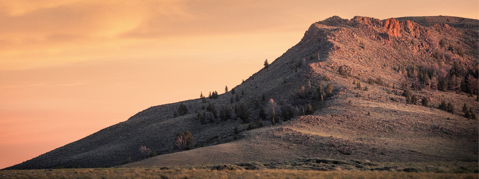
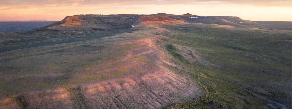
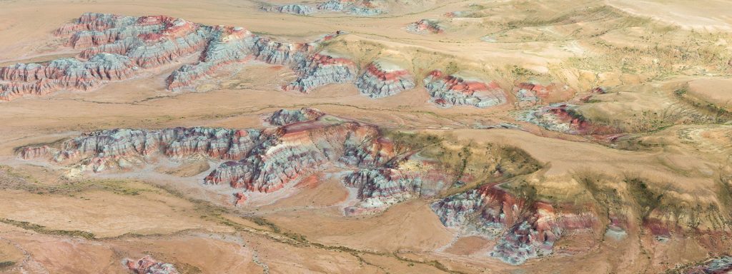
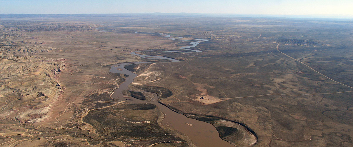
Rock Springs Resource Management Plan
A plan nearly 12 years in waiting, the Rock Springs Resource Management Plan outlines how much of the northern Red Desert — including the Big Sandy Foothills, Adobe Town, and more — will be managed for the next 15–20 years. The draft plan favors conservation of the Red Desert’s extraordinary habitat, cultural resources, and wide-open spaces while protecting opportunities for recreation. In December, WOC represented conservation on a task force convened by the governor to form consensus recommendations for the BLM alongside livestock, oil and gas, sporting groups, and other interests. Much common ground was found as we defended the Red Desert’s key landscapes from potentially damaging proposals.
There’s a good chance you heard and answered our calls to advocate for the Red Desert’s treasures. The public comment period on the draft RMP ended in January, and we’re confident that your passionate advocacy will result in a strong final plan. Thank you for your many supportive comments.
THANK YOU
As time marches on, it’s essential that we continually revisit, refine, and revise the rules and plans guiding management of our public lands. The items listed above are the finalized and in-progress products of this important process. They represent the modernizing of old policies that often had the effect of undermining conservation interests. They are also significant strides towards more proactive management of our public lands.
Importantly, the true value of these rules and plans lies with the public input that helped to build them. They are valuable because people like you spoke up — people who care for, understand, recreate or work on, live near, and love these public lands. As these frameworks for management move from draft stage to final rule or plan, we can’t thank you enough for your support and advocacy. Wyoming’s public lands are better for it!
Have lingering questions about recent BLM rules and land use revisions? Send us an email or write a comment below.
On Wednesday, July 15, we received some good news.
In a series of challenges that have been ongoing for nearly four years, a federal district court in California found that the Bureau of Land Management illegally repealed a 2016 rule designed to improve air quality, slow the progress of climate change, and provide a fair return for taxpayers by reducing the amount of natural gas lost through leaks, venting, and flaring from oil and gas development on public and tribal lands.
The BLM’s 2016 methane waste prevention rule updated 30-year-old regulations regarding the agency’s congressional mandate to prevent waste of publicly owned oil and gas resources. This common-sense and much needed update protects our public lands, air quality, and our health by requiring oil and gas companies to conduct inspections and repair leaks that endanger human health and contribute to climate change. Because the pollution captured is also the product to be sold, these inspections and fixes end up paying for themselves. The rule helps ensure that natural gas owned by the American taxpayers generates revenue for our schools, public infrastructure, and social services, instead of literally being cast to the wind.
But oil and gas industry groups — as well as Wyoming, Montana, and North Dakota — challenged the rule. The Wyoming Outdoor Council joined 17 public health, Indigenous rights, and conservation organizations, along with New Mexico and California, to help the BLM defend the rule in Wyoming federal district court.
When President Donald Trump was elected, the BLM changed course. At industry’s urging, the BLM first sought to not enforce the rule and then took steps to repeal it altogether. We soon found ourselves on the other side of the courtroom as plaintiffs challenging the BLM’s 2018 “rescission rule.” The court’s decision on Wednesday means that the 2016 rule will be reinstated.
While industry lobbying groups will likely challenge the 2016 rule — and we’ll be back in Wyoming district court to defend the rule again — the decision to reinstate it represents a huge victory for common-sense management of a valuable public resource. Notably, during the legal limbo of the past four years, more and more oil and gas companies have voluntarily adopted the requirements of the rule — because they’re cost effective and good PR for an industry under scrutiny for its contributions to climate change.
More than $2.5 billion in natural gas has been lost to venting, flaring, or fugitive emissions on public and tribal lands since 2013. This loss also contributes to climate change — methane is a greenhouse gas and a serious contributor to global warming — and releases pollutants such as benzene into the air.
As a 53-year old organization, the Wyoming Outdoor Council learned long ago not to rely exclusively on federal administrative rules for lasting policy change. This is a textbook example of why we don’t. The shifting politics of Washington D.C. mean any victories gained under one administration could be on the chopping block during the next.
For this reason, even while we sought to defend the BLM’s national rule, we worked tirelessly with the state of Wyoming, the Department of Environmental Quality, and operators here in Wyoming to ensure state-level standards for leak detection and repair of fugitive emissions. In 2018, the DEQ finalized these requirements and they apply statewide in new and modified oil and gas fields. Ultimately, we’d like the state to require the same practices for existing oil and gas fields.
Our work to combat climate change, protect public health, and support policies that reduce unnecessary lost revenue for the state of Wyoming will continue and we’ll keep you posted on our progress.
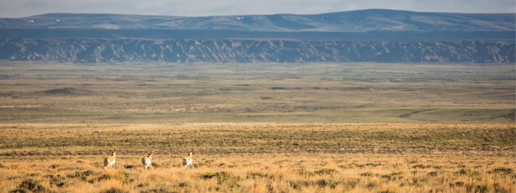
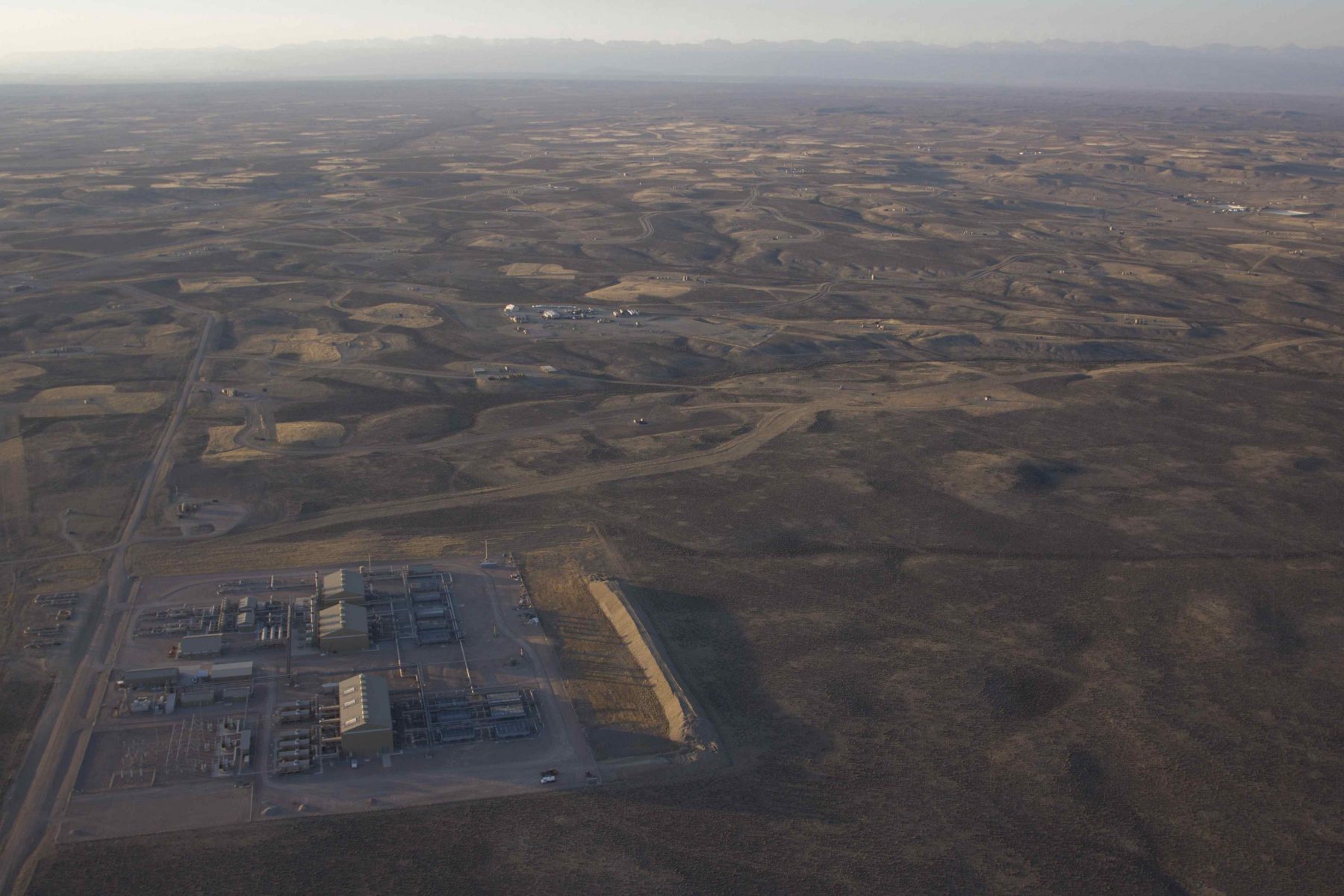
Some good news to report! Oil and gas operator Greater Rocky Mountain Resources has abandoned plans to drill more than a dozen wells in some of the most important and sensitive wildlife habitat in the state.
In March, investment firm-backed GRMR (based in Colorado) notified the Bureau of Land Management Rawlins Field Office it would “release” federal permits to drill the wells — which could have set the stage for major industrial development spanning 136.5 square miles in the Little Snake River Valley near Baggs. The development would have taken place inside mule deer crucial winter range, migration corridors, and priority (“core”) habitat for Greater sage-grouse. The area is also home to the largest population of Columbian sharp-tailed grouse anywhere in the Rockies.
The picturesque Little Snake River Valley is treasured hunting grounds, and home to sheep, cattle, and irrigated agriculture operations. As the conservation group EcoFlight put it, “The Little Snake River Valley is one of the few remaining intact river valleys in the West that has not experienced rampant development.”
In places where oil and gas development is appropriate the Wyoming Outdoor Council works hard to see it “done right” by advocating that operators mitigate impacts to air, water, and wildlife. But in other places, mitigation is not sufficient.
“This is a great example of an area that should never have been leased in the first place,” Senior Conservation Advocate Dan Heilig said. “These are rare habitats, and there’s simply no way to accommodate an industrial development here without sacrificing native wildlife, open spaces, clean air and water, and tranquility in the Little Snake River Valley.”
The Wyoming Outdoor Council worked with local ranchers and partner organizations to advocate more effective stipulations to protect vital mule deer and sage-grouse habitat. We reviewed BLM’s analysis and permitting, and asked for revisions to correct deficiencies in the federal plans. WOC, along with Little Snake River Valley locals, The Nature Conservancy, National Audubon Society, Theodore Roosevelt Conservation Partnership, and the Wyoming Game and Fish Department advocated better analysis of cumulative impacts of the overall development.
“It was evident that GRMR and the BLM hadn’t done their homework,” Heilig said. “Thanks to the dedication of local ranchers and advocacy among many partners, the operator decided to abandon the project — a huge win for some of Wyoming’s most precious wildlife habitat that simply can’t be replaced.”
There isn’t much traffic on Birdseye Pass Road just outside Shoshoni in north-central Wyoming, despite the fact that it carves around the southern and eastern borders of the Copper Mountain Wilderness Study Area — a place that the U.S. Bureau of Land Management proclaims has “outstanding” potential for “primitive and unconfined recreation.”
Traffic will pick up in September when hunters begin scouting the area for deer and elk. Meantime, there’s always the occasional out-of-town vehicle that’ll stray from county road to private. These drivers often avoid stopping to visit with a local rancher who pulls over for a quick hello, and to maybe offer some advice.
[learn_more caption=”What are Wilderness Study Areas?”] Wilderness Study Areas originated from the Federal Lands Policy and Management Act of 1976 which required the identification of federal lands with “wilderness characteristics.” As such, lands are either recommended for wilderness or a host of other potential designations. Only Congress has the authority to make the designation based on the recommendations of the Bureau of Land Management and the U.S. Forest Service. In Wyoming, there are 42 BLM WSAs. (Source: Wyoming Public Lands Initiative) [/learn_more]
“We call ‘em Lookie-Lous,” Garrett Herbst says as he grinds pickup and loaded horse trailer up this road toward the family’s old homestead. They’re mostly harmless and well-intentioned, the 31-year-old fourth generation rancher adds. There’s a common perception that ranchers are unapproachable, and maybe even downright grouchy toward the average person looking to recreate among the patchwork of public and private land in Wyoming.
Herbst says that’s a perception ranchers need to try to change, for their own survival.
“We gotta take just a little time to visit, and help people know where they can be and do it right. That’s the type of thing we need to encourage, or eventually — ranchers are kind of a dying breed as it is — people are going to make it harder for ranchers if we don’t start helping them enjoy what’s around us.”
Garrett Herbst prepares for a ride through the northern portion of the Copper Mountain Wilderness Study Area where his family grazes cattle in the summer. For four generations, the Herbst family has packed in salt for wintering horses and summer cattle. (photo: Dustin Bleizeffer)
The Herbst family, and many ranchers like them, depend on grazing allotments on public lands. The Herbsts, for example, have grazed cattle here every summer for 100 years. Ranchers know these public landscapes better than most, yet Garrett Herbst worries they risk alienating themselves from other public land users when it comes to land management planning for the future.
Those risks are at play right now for the Copper Mountain Wilderness Study Area and 42 other WSAs in Wyoming currently under consideration for permanent land management changes. For the past two years a handful of counties have taken part in the Wyoming Public Lands Initiative, an effort to find broad-based consensus on the future management of WSAs as the basis for congressional legislation to move all or some of the WSAs in Wyoming from a temporary status to a mix of wilderness and other management priorities.
[learn_more caption=”What is the Wyoming Public Lands Initiative?”] The Wyoming Public Lands Initiative is a voluntary, collaborative process led by counties regarding the future management of Wilderness Study Areas in the state. The goal is to find local stakeholder consensus for how each Wilderness Study Area is managed, and to send those recommendations to Congress for potential new legislation guiding the permanent management of the WSAs. (Source: Wyoming Public Lands Initiative)[/learn_more]
Existing grazing allotments in the WSAs — such as the Herbsts’ in the northern portion of Copper Mountain — are grandfathered in the existing plans, and won’t be revoked. But a wide range of new uses are under consideration, including off-road vehicle use and new motorized vehicle trail systems.
Rock crawlers in a roadless area?
There’s no water to fish here, but a scramble to any hilltop provides stunning views of a desert-like plains to the south, Boysen Reservoir and the Absaroka Range to the west.
Copper Mountain offers a wealth of geologic and cultural resources, and challenging terrain for hikers and backpackers. There are rockfaces to climb and deep gullies rumored to hide ancient cedars. Garrett complains there’s too many mountain lions and rattlesnakes to his liking in this dry sagebrush- and juniper-covered landscape. But it provides critical refuge for the deer and elk that move into the northern and eastern parts of Copper Mountain to survive especially harsh winters, earning a portion of the WSA critical winter range habitat protections.
It’s all of these qualities, after all, that earned Copper Mountain the designation of Wilderness Study Area decades ago. This is a place that is remarkably untouched and wild. There are no roads. Anyone is free to come here and enjoy a sense of solitude — by foot or by hoof. It’s the landscape people think of when they imagine Wyoming. But the Herbsts fear these qualities may one day be lost.
There’s a lot for people to enjoy on Copper Mountain where the BLM Wilderness Study Area spans 6,858 acres of hilly, rocky terrain wedged between the Wind River Canyon to the west and the rest of Copper Mountain to the east, nestled at the southwestern edge of the Bighorn Mountain Range. On a horseback tour of the area in June, Garrett Herbst and his father Tom Herbst spotted tepee rings and mountain bluebirds darting over steep slopes speckled with budding Indian Paintbrush. (photo: Dustin Bleizeffer)
So far, the Fremont County Public Lands Committee still implicitly includes the “bottom-third” portion of the Copper Mountain WSA — just 2,000 roadless acres among 2.1 million BLM acres across the larger north-central portion of the state — in its recommendation for a motorized use study. Garrett, his father Tom Herbst, and many other locals worry that recommending such a study may be interpreted as a mandate to accommodate off-road vehicles — ATVs and even “rock crawlers” specifically designed to maw and mount rocky crags and other rugged but sensitive terrain.
While riding horseback through the “bottom-third,” Tom Herbst noted that the reason there are no roads here is because the terrain is too hilly and the soils are too delicate. A track carved by motorized wheels — even a groomed trail — would cause erosion, likely leading to another route that encourages even more erosion.
The Herbsts’ grazing allotment is situated on the northern end of the Copper Mountain WSA, which comes with the WSA-wide restriction of no motorized use. For four generations, they’ve packed in salt for wintering horses and summer cattle, and they’ve packed in materials to maintain fences and to coax spare mountain spring watering holes. That’s how it’s been done for generations — even before the WSA guidelines were established decades ago.
Opening the area to off-road vehicles would damage every quality that earned Copper Mountain its wilderness study designation in the first place, the Herbsts say. They want the Copper Mountain WSA to be excluded from any recommendation for an ORV suitability study, and they’ve gathered more than 200 signatures from others — mostly locals — who agree.
Copper Mountain grazers like the Herbsts don’t want to see the roadless area opened to motorized use. For generations, the family has packed in salt for wintering horses and summer cattle, because the landscape isn’t suited for motorized vehicles. (photo: Dustin Bleizeffer)
“It’s not good for hunters, not good for hikers, not good for wildlife. It’s only good for the ORV user,” Tom Herbst said. “Here’s the other thing for ranchers: conservation is critical in an arid area like this. If we don’t kind of conserve it, we don’t have grazing. We’ve got to take care of it.”
As Garrett and Tom find allies among the ranching community and initiate conversations to elevate suitable recreation opportunities at Copper Mountain — such as climbing, birding, and hiking — they feel the Fremont County advisory committee hasn’t taken their wishes, concerns, and local knowledge into account.
Are public lands committees listening to the public?
The Wyoming Public Lands Initiative set out to resolve the temporary status of WSAs — in limbo for nearly three decades. Each county with a WSA was encouraged but not required to participate. The initiative recognized that a consensus set of recommendations created by a broad coalition of stakeholders stands the best chance of support for congressional legislation.
WPLI’s charter states that “County WPLI Advisory Committees will be expected to encompass a broad cross-section of public lands stakeholders.” The initiative’s Principles and Guidelines state that Public Lands Committees “allow for public comment opportunities at all of the committee’s meetings” — a charge that participating committees have honored; most provided multiple opportunities, and even online comment submissions.
But the guidelines do not say how public comments are to be considered by the committees, or integrated into the committees’ final recommendations.
Neil Long is a climber who lives in Casper in neighboring Natrona County. He’s among many local climbers who frequently scale granite walls inside the four WSAs that comprise the Sweetwater Rocks complex far south of Copper Mountain. Neil and many of his fellow climbers have read through committee meeting minutes and reached out to members of the Fremont County Public Lands Committee to share their input. Neil shares the same concern as the Copper Mountain ranchers — that the committee appears to listen, but then doesn’t seem to incorporate broad public agreement into its decisions.
“I reached out and got responses ranging from no response and neutral response, and that public opinion isn’t going to persuade some [committee] members,” Neil said.
Like the Herbsts, Todd Humphreys works a grazing allotment in the Copper Mountain WSA, carrying on a 90 year family tradition. In that time there have been dustups about land use, he said, but things have worked nicely the past few decades among local ranchers, the Bureau of Land Management, and the public under the WSA designation. Humphreys says he shares the view that ranchers need to be partners with land managers and the general public that wants to enjoy the wild, roadless area.
“We have to learn how to share this,” Humphreys said. “Other people need to enjoy this too — the people who appreciate it.”
Copper Mountain grazer Tom Herbst said his family and the general public have benefited from the “wilderness” protections applied to the area for the past three decades. “I think the benefit of wilderness is it creates more respect for the land,” he said. (photo: Dustin Bleizeffer)
Humphreys acknowledged public land grazers sometimes butt heads with the BLM in some areas, but it’s working out on Copper Mountain. “The Wilderness Study Area is no problem with us,” he said. “Even if it’s [permanently] made a wilderness area, we can work with that, and we can work with the BLM. We just don’t want motorized vehicles in there with trails and trash.”
Humphreys attended several Fremont County Public Lands Initiative committee meetings, wrote comments, and helped organize with other locals, and said he appreciates the task and the manner in which the committee has worked.
“But when it came down to recommendations for this area, it seems like they protected other [WSAs in Fremont and Natrona counties] but backed off of Copper Mountain. I think there are some interests there who are not concerned with Copper Mountain, and they blocked everything we tried to conserve.”
Two committee members refused to support the draft recommendation, in part because of concerns over the potential for motorized access to areas like Copper Mountain. But it’s unclear whether the Copper Mountain ranchers will be heard as recommendations move from committee to the county commission and perhaps to Congress.
“All 325 million people in the United States have the right to be on public ground. Now it’s just a matter of how are we going to use certain parts of it?” Garrett Herbst said. “Because certain places may be suitable for certain activities. Other places — especially like we feel about this — there’s absolutely no motorized trails. Why destroy this little piece?”
Over the next few months, committees around Wyoming will seek public input as they work to finalize sets of recommendations for this and other public landscapes. You can follow the progress here at wyomingoutdoorcouncil.org, and on our Facebook page.
NOTE: This is the first of a 3-part series about the Wyoming Public Lands Initiative, now in its final stages of approving recommendations to send to Congress.
Wyoming citizens can tell Interior Secretary Ryan Zinke not to scrap commonsense protections for sage-grouse and the sagebrush ecosystem at two BLM meetings later this month.
The open-house meetings, to be held in Cheyenne and Pinedale, will provide an opportunity for the public to learn more about — and comment on — an ill-conceived BLM proposal that would eliminate habitat protections developed as part of a historic, West-wide conservation plan.
That plan, which Wyoming Governor Matt Mead helped craft and which was approved with broad bipartisan support in 2015, would help maintain healthy sage-grouse populations, as well as vibrant mule deer, elk, and pronghorn herds, and hundreds of other species that rely on intact sagebrush habitat. The plan’s conservation measures are widely credited with keeping the Greater sage-grouse off the endangered species list.
A Collaborative West-wide Conservation Plan Scrapped in the Name of “Energy Dominance”
Although the Trump administration touts the importance of state engagement and local input, its actions tell a different story.
In what many see as an egregious concession to mining and oil and gas lobbyists, Secretary Zinke last fall ordered his agency to reconsider the historic sage-grouse conservation plans that western stakeholders took years to craft.
These plans, which apply to 11 western states, are a wildly successful example of state engagement and local input. They were endorsed by western governors, conservationists, sportsmen, and many in the agricultural and oil and gas communities. The plans’ protections were modeled after Wyoming’s own strong sage-grouse conservation measures; the best available science, attention to balance development and wildlife management needs, and to keep the Greater sage-grouse from being listed as a threatened or endangered species. The approval of these plans in 2015 was a resounding success story. And Wyoming citizens know it.
The Interior Department listened . . . sort of. The BLM has now released draft amendments for each of the 11 states that signed on to the 2015 conservation plan. The amendments to Wyoming’s plan propose keeping some of our good protections. But taken as a whole, the amendments don’t do enough to ensure that sage-grouse populations across the West will be protected.
As Secretary Zinke must understand, keeping the Greater sage-grouse off the endangered species list goes beyond ensuring smart management only in Wyoming. Protecting the species — and its sagebrush habitat — across the west is essential. But the BLM is drastically reducing habitat protections in eight of the 11 states that are part of the West-wide plan, leaving just three — Wyoming, Montana, and Oregon — to carry the weight of protecting this iconic western species. And several changes in the plan proposed for Wyoming will hurt sage-grouse populations right here.
Tell Secretary Zinke: Honor the Deal!
The Department of Interior is currently taking public comment on its draft amendment for Wyoming. If you’re in Pinedale or Cheyenne next week, please attend a BLM open-house meeting to learn more. The BLM is taking public comment on the proposal right now. Come learn more and ask questions at the open houses next week as we prepare to send comments on behalf of our members in August.
Here are a few key points to make in your comments:
Without reliable, West-wide measures to address ongoing and increasing threats to the Greater sage-grouse and its habitat, we’re likely to find ourselves right back where we started: facing a listing under the Endangered Species Act. That’s not good for the sage-grouse and it’s not good for westerners.
Wyoming, Montana, and Oregon should not be the only states responsible for range-wide support of the sage-grouse population. The remaining states must help carry the weight. All 11 states that signed on to the 2015 conservation plan must be accountable for their share of the habitat and bird populations.
The proposal doesn’t do enough in terms of mitigation. The BLM must do everything in its power to improve habitat that has been lost or degraded due to development.
The proposal provides for more flexibility for “adaptive management.” Although flexibility might make sense, any departures from the original conservation directives must be transparent and backed by the best available science.
Want to know more? Email the Outdoor Council’s Senior Conservation Advocate, Dan Heilig at dan@wyomingoutdoorcouncil.org.